

-
摘要:
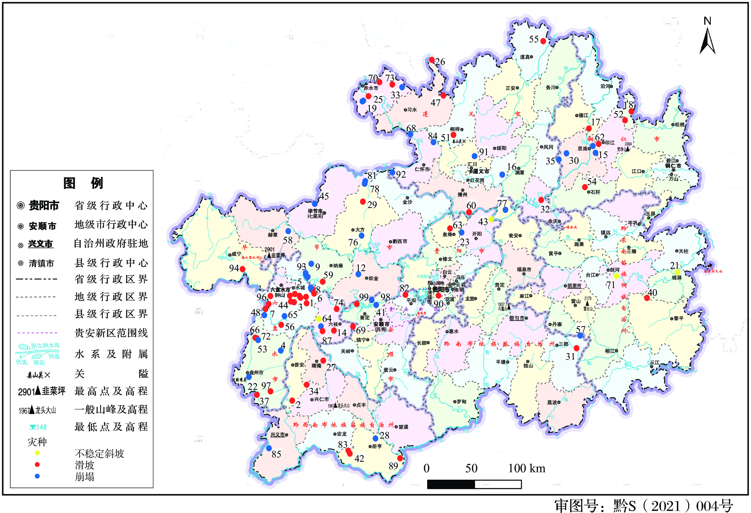
我国地质灾害具有点多面广的分布特点,而地质灾害风险管控人力和能力有限,因此需要开展地质灾害风险排序工作,筛选出优先管控的地质灾害隐患点,确保地质灾害风险管控对策实施的针对性和高效性。地质灾害风险排序的实质是运用定量化风险评价计算出每处隐患点的风险值,然后根据风险值开展排序工作。目前定量化风险评价模型多用于单个地质灾害点风险评价,并未应用于大范围地质灾害风险排序工作,且模型较为复杂,推广应用较难。在分析崩塌、滑坡地质灾害与其环境因素间的响应关系及规律的基础上,提取崩塌、滑坡地质灾害的主控环境因子与诱发因子,联合人口、物质、资源等易损性因子建立地质灾害风险评价指标体系;基于岩石工程系统相互作用矩阵与专家打分法确定各级地质灾害风险评价指标因子权重,构建地质灾害风险评分体系;并根据风险评价定义,提出了能够快速定量化的简易地质灾害风险计算模型。以贵州省98处地质灾害隐患点为例,开展模型应用验证,风险排序结果与灾害管理机构主观认识的实际风险一致,验证了本模型的合理性与有效性,提高了地质灾害风险管控能力与效率。
Abstract:Geological disasters in China are characterized by multi-point and wide-range distribution, while the manpower and ability of geological disaster risk management and control are relatively limited. Therefore, it is necessary to carry out the sequencing work of geological disaster risk, screen out the geological disaster points for priority control and control, and ensure the pertinency and efficiency of the implementation of geological disaster risk management and control countermeasures. The essence of geological hazard risk ranking is to use quantitative risk evaluation to calculate the risk value of each disaster point, and then carry out the ranking work according to the risk value. At present, the quantitative risk assessment model is mostly used in the risk assessment of a single geological disaster point, but is not applied in the risk ranking work of a wide range of geological disasters. Moreover, the model is relatively complex, so it is difficult to popularize and use it. Based on the analysis of the response relationship and law between the collapse-landslide geological disasters and its environmental factors, this paper extracts the main controlling environmental factors and inducing factors of the collapse landslide geological disasters, and establishes the risk evaluation index system of geological disasters together with the vulnerable factors such as population, material and resources. Based on the interaction matrix of rock engineering system (RES) and expert scoring method, the weight of each level of geological hazard risk evaluation index factor is determined, and the geological hazard risk scoring system is constructed. According to the definition of risk assessment, a simple geological hazard risk calculation model which can be quantified quickly is proposed. Taking 98 potential geological hazards in Guizhou province as an example, the model verification and application were carried out by taking 98 potential geological hazards in Guizhou province as examples. The risk ranking results are consistent with the actual risks recognized by the disaster body management agencies, which verify the rationality and effectiveness of the model and greatly improve the ability and efficiency of geological disaster risk management and control.
-

-
表 1 地质灾害风险评分体系
Table 1. Geological disaster risk scoring system
因子类型 一级评价因子
(权重)二级评价因子
(权重)三级分级(权重) 因子类型 一级评价因子
(权重)二级评价因子
(权重)三级分级(权重) 地质灾害基础地质环境条件因素(易发性评价指标体系) 几何特征参数(16.67) 斜坡高度(31.82) h<50 m(1) 地质灾害诱发因素与后效应参数(发生概率指标体系) 诱发因素参数(32.14) 人类工程活动(50) 无(0) 50 m≤h<100 m(4) 灌溉活动(3) 100 m≤h<150 m(7) 不合理切坡、蓄水(7) h≥150 m(10) 采矿活动、修建隧道(10) 斜坡坡度(31.82) 滑坡:θ<15°、
崩塌:θ<25°(1)降雨(50) <1000 mm(1) 滑坡:15°≤θ<30°、
崩塌:
25°≤θ<50°(4)1000~1200 mm(4) 滑坡:30°≤θ<45°、
崩塌:
50°≤θ<75°(7)1200~1400 mm(7) 滑坡:θ≥45°、
崩塌:θ≥75°(10)>1400 mm(10) 潜在失稳范围方量(36.36) 小型(1) 运动参数(32.14) 灾害体下部是否
有拦挡物(50)挡墙(2) 中型(4) 茂盛高大树木、竹排墙(5) 大型(7) 低矮树木、拦石网(7) 特大型(10) 无(10) 岩土体特征
参数(33.33)岩土体类型(24.48) 土质(10) 失稳后扩展模式(50) 缩减型(1) 碎屑(4) 约束型(3) 岩质(1) 向前(下)推移(5) 斜坡结构类型(21.43) 逆向坡(1) 向后(上)扩展(7) 水平坡(3) 扩大型(10) 灾害发生后效应(35.72) 是否会发生涌浪、堰塞湖等次生灾害(100) 否(0) 是(100) 斜向坡(5) 地质灾害易损性参数(易损性指标体系) 人员易损性(40.62) 威胁人数(100) 无(0) 顺向坡(8) 1-10人(1) 基覆界面坡(10) 11~30 人(3) 控滑结构面倾角(17.35) θ<30°(1) 31~100 人(5) 30°≤θ<50°(4) 101~1000 人(7) 50°≤θ<70°(7) >1000 人(10) θ≥70°(10) 经济易损性(34.38) 威胁房屋(30) 无(0) 岩体结构(18.37) 次块状、块状、
整体结构(1)1~10 间(1) 碎块状、镶嵌、
松弛结构(6)11~20 间(3) 松动、散体、
碎裂结构(10)21~50 间(5) 工程岩组(18.37) 坚硬岩(1) 51~100 间(7) 中等坚硬岩(3) >100 间(10) 软弱岩体(7) 威胁道路(30) 无(0) 松散体(10) 乡道(3) 灾害体状态
参数(50)地表变形强度(40) 地表未发现明显
变形破坏现象(1)县道(5) 地表产生少量裂缝,
未贯穿坡体(4)省道(7) 地表产生大量张拉
裂缝,圈闭等(10)国道(10) 防灾工程(16.37) 开展防灾教育,
开展工程治理(0)是否有大型工厂(40) 无(0) 进行多类型地质
灾害监测(3)有(10) 开展防灾教育,
树立警示牌(7)资源易损性(25) 主要威胁对象(100) 学校、医院(10) 无任何防灾工程(10) 旅游区(9) 变形阶段(43.63) 稳定阶段(1) 工厂(7) 蠕滑阶段(3) 居民地(5) 加速阶段(7) 道路(3) 临滑阶段(10) 土地(1)  下载: 导出CSV
表 2 风险指标值
Table 2. Risk indicator values
序号 隐患点名称 易发性值 危险性值 易损值 风险值 1 马路组崩塌 0.656 0.359 0.810 0.291 2 小偏坡滑坡 0.591 0.352 0.777 0.273 3 园林组滑坡 0.557 0.304 0.864 0.263 4 松树坡组滑坡 0.594 0.353 0.714 0.252 5 丫口组崩塌 0.609 0.333 0.714 0.238 6 岩脚组滑坡 0.534 0.249 0.886 0.221 7 金竹组滑坡 0.590 0.322 0.681 0.219 8 苦瓜地崩塌 0.455 0.249 0.809 0.201 9 马路组崩塌 0.656 0.359 0.810 0.291 10 大偏坡滑坡 0.591 0.352 0.777 0.273 18 杨莫洞崩塌 0.719 0.358 0.407 0.146 


24 两河口滑坡 0.461 0.156 0.867 0.135 


38 椒子坪崩塌 0.623 0.170 0.659 0.112 


67 偏坡组滑坡 0.709 0.624 0.168 0.105 


 下载: 导出CSV
表 3 前五处隐患点信息详情
Table 3. Information summary of the first five disasters
序号 隐患点名称 隐患点特征 1 马路组崩塌 总体积约4.26×10⁶ m3,组成物质为砂页岩及松散第四系黏土。坡体结构面发育,坡表浅层岩体为碎裂结构,坡内一定深度岩体为镶嵌-碎裂结。坡顶出现拉张裂缝、塌陷、坡表垮塌、坡顶树木倾倒歪斜等。地下采矿引起;威胁599人、潜在受威胁财产约8 500万元;欠稳定状态 2 小偏坡滑坡 总体积约9.22×10⁶ m3,斜坡结构呈上陡下缓形态,组成物质为泥岩、泥质粉砂岩,岩体节理裂隙发育,岩体破碎。变形破坏特征主要以山顶多条宽约1 m裂缝和坡体中部危岩体为主。地下采矿引起;威胁156人、潜在威胁资产约8 000万元;欠稳定状态 3 园林组滑坡 总体积约1.20×10⁶ m3,斜坡物质组成以崩坡积泥岩、泥质灰岩、砂岩块碎石土为主,基岩节理裂隙发育呈层状碎裂结构或镶嵌碎裂结构,主要受产状为298°∠85°及缓倾坡内产状为34°∠12°的层面两组裂隙控制。滑坡后缘已产生两条长度近100 m的平行于斜坡走向的主控裂缝。地下采矿活动引起;威胁295人、固定资产约千万元以上;欠稳定状态 4 松树坡组滑坡 总体积约0.45×10⁶ m3,主要为三叠系下统飞仙关组泥质粉砂岩为主,结构面发育,发育3组结构面:J1:332°∠71°;J2:65°∠69°;J3:13°∠67°,较破碎。滑坡后缘有多条宽约0.5~1 m,长约20~30 m的裂缝。地下采煤活动引起;威胁476人、固定资产约4 500万元;欠稳定状态 5 丫口组崩塌 总体积约7.42×10⁶ m3,崩塌方向225°,组成物质为砂页岩及松散第四系黏土。发育三组优势结构面(C: 162°∠18°、J1: 333°∠89°、J2: 247°∠82°)。坡体结构面发育,坡表浅层岩体为碎裂结构,坡内一定深度岩体为镶嵌-碎裂结构。崩塌体后缘发现多条地裂缝,崩塌体前缘发生崩塌,崩塌堆积物分布于坡脚,呈倒扇形分布,地下采煤活动引起;威胁469人、潜在受威胁财产约3 700万元;欠稳定状态
下载: 导出CSV
-
[1] 刘传正, 陈春利. 中国地质灾害防治成效与问题对策[J]. 工程地质学报,2020,28(2):375 − 383. [LIU Chuanzheng, CHEN Chunli. Achievements and countermeasures in risk reduction of geological disasters in China[J]. Journal of Engineering Geology,2020,28(2):375 − 383. (in Chinese with English abstract)
[2] COOPER D F. Project risk management guidelines: Managing risk in large projects and complex procurements[M]. Chichester: John Wiley & Sons, 2005.
[3] 戴婧, 毕军, 马宗伟. 风险排序及其在环境风险管控中的应用[J]. 环境监控与预警,2016,8(1):1 − 4. [DAI Jing, BI Jun, MA Zongwei. Risk ranking and its applications in environmental risk management[J]. Environmental Monitoring and Forewarning,2016,8(1):1 − 4. (in Chinese with English abstract) doi: 10.3969/j.issn.1674-6732.2016.01.001
[4] MALONE A W, 黄润秋. 香港的边坡安全管理与滑坡风险防范[J]. 山地学报,2000,18(2):187 − 192. [MALONE A W, HUANG Runqiu. Slope safety and landslides risk management[J]. Journal of Mountain Science,2000,18(2):187 − 192. (in Chinese with English abstract) doi: 10.3969/j.issn.1008-2786.2000.02.017
[5] 向喜琼. 区域滑坡地质灾害危险性评价与风险管理[D]. 成都: 成都理工大学, 2005.
XIANG Xiqiong. Regional landslide assessment and risk management[D]. Chengdu: Chengdu University of Technology, 2005. (in Chinese with English abstract)
[6] PUN W K, CHUNG P W K, WONG T K C, et al. Landslide risk management in Hong Kong - experience in the past and planning for the future[J]. Landslides,2020,17(1):243 − 247. doi: 10.1007/s10346-019-01291-8
[7] KONG V W W, KWAN J S H, PUN W K. Hong Kong’s landslip warning system—40 years of progress[J]. Landslides,2020,17(6):1453 − 1463. doi: 10.1007/s10346-020-01379-6
[8] FELL R, HO KKS, LACASSE S, et al. A framework for landslide risk assessment and management[C]/ /HUNGR O, FELL R, COUTURE R, et al. Landslide risk management. Vancouver: Taylor & Francis, 2005: 3-25.
[9] 唐亚明, 冯卫, 李政国, 等. 滑坡风险管理综述[J]. 灾害学,2015,30(1):141 − 149. [TANG Yaming, FENG Wei, LI Zhengguo, et al. An overview of landslide risk management[J]. Journal of Catastrophology,2015,30(1):141 − 149. (in Chinese with English abstract) doi: 10.3969/j.issn.1000-811X.2015.01.027
[10] 陈伟. 西南山区城镇建设地质灾害风险管理控制方法研究[D]. 成都: 成都理工大学, 2011.
CHEN Wei. Study on geohazard risk management methods in southwest mountain towns construction[D]. Chengdu: Chengdu University of Technology, 2011. (in Chinese with English abstract)
[11] VAN WESTEN C J, VAN ASCH T W J, SOETERS R. Landslide hazard and risk zonation-why is it still so difficult?[J]. Bulletin of Engineering Geology and the Environment,2006,65(2):167 − 184. doi: 10.1007/s10064-005-0023-0
[12] 范强, 巨能攀, 解明礼, 等. 2017年九寨沟MS7.0地震前后地质灾害风险对比[J]. 地震研究,2019,42(3):419 − 427. [FAN Qiang, JU Nengpan, XIE Mingli, et al. Comparation of geological hazard risks before and after Jiuzhaigou MS7.0 Earthquake in 2017[J]. Journal of Seismological Research,2019,42(3):419 − 427. (in Chinese with English abstract) doi: 10.3969/j.issn.1000-0666.2019.03.016
[13] DAI F C, LEE C F, NGAI Y Y. Landslide risk assessment and management: An overview[J]. Engineering Geology,2002,64(1):65 − 87. doi: 10.1016/S0013-7952(01)00093-X
[14] LUO H Y, ZHANG L L, ZHANG L M. Progressive failure of buildings under landslide impact[J]. Landslides,2019,16(7):1327 − 1340. doi: 10.1007/s10346-019-01164-0
[15] CHAPMAN C. Project risk analysis and management—PRAM the generic process[J]. International Journal of Project Management,1997,15(5):273 − 281. doi: 10.1016/S0263-7863(96)00079-8
[16] 解明礼. 矿山崩滑地质灾害风险评价与管理研究[D]. 成 都: 成都理工大学, 2018.
XIE Mingli. Risk assessment and management of landslide geohazards induced by underground mining[D]. Chengdu: Chengdu University of Technology, 2018. (in Chinese with English abstract)
[17] WARD S C. Assessing and managing important risks[J]. International Journal of Project Management,1999,17(6):331 − 336. doi: 10.1016/S0263-7863(98)00051-9
[18] 刘传正. 论地质灾害风险识别问题[J]. 水文地质工程地质,2017,44(4):1 − 7. [LIU Chuanzheng. Research on the risk recognition of geological disasters[J]. Hydrogeology & Engineering Geology,2017,44(4):1 − 7. (in Chinese with English abstract)
[19] 刘传正. 崩塌滑坡灾害风险识别方法初步研究[J]. 工程地质学报,2019,27(1):88 − 97. [LIU Chuanzheng. Analysis methods on the risk identification of landslide disasters[J]. Journal of Engineering Geology,2019,27(1):88 − 97. (in Chinese with English abstract)
[20] 何宇航, 裴向军, 梁靖, 等. 基于Rockfall的危岩体危险范围预测及风险评价—以九寨沟景区悬沟危岩体为例[J]. 中国地质灾害与防治学报,2020,31(4):24 − 33. [HE Yuhang, PEI Xiangjun, LIANG Jing, et al. Risk assessment and range prediction of dangerous rockmass based on rockfall: a case study of the Xuangou Collapse[J]. The Chinese Journal of Geological Hazard and Control,2020,31(4):24 − 33. (in Chinese with English abstract)
[21] 李滨, 殷跃平, 高杨, 等. 西南岩溶山区大型崩滑灾害研究的关键问题[J]. 水文地质工程地质,2020,47(4):5 − 13. [LI Bin, YIN Yueping, GAO Yang, et al. Critical issues in rock avalanches in the karst mountain areas of southwest China[J]. Hydrogeology & Engineering Geology,2020,47(4):5 − 13. (in Chinese with English abstract)
[22] 陈筠, 郭果. 基于RES理论的潜在滑坡识别[J]. 工程地质学报,2014,22(3):456 − 463. [CHEN Jun, GUO Guo. Rock engineering system based identification model for potential landslide[J]. Journal of Engineering Geology,2014,22(3):456 − 463. (in Chinese with English abstract)
[23] 朱立军, 黄润秋, 朱要强, 等. 中国西南岩溶山地重大地质灾害成灾机理与监测预警系统研究[M]. 北京: 科学出版社, 2018.
ZHU Lijun, HUANG Runqiu, ZHU Yaoqiang, et al. Study on the mechanism and monitoring and early warning system of major geological disasters in karst mountainous areas of southwest China [M]. Beijing: China Science Publishing House, 2018. (in Chinese)
-


图(3)
表(3)
计量
- 文章访问数: 2333
- PDF下载数: 150
- 施引文献: 0